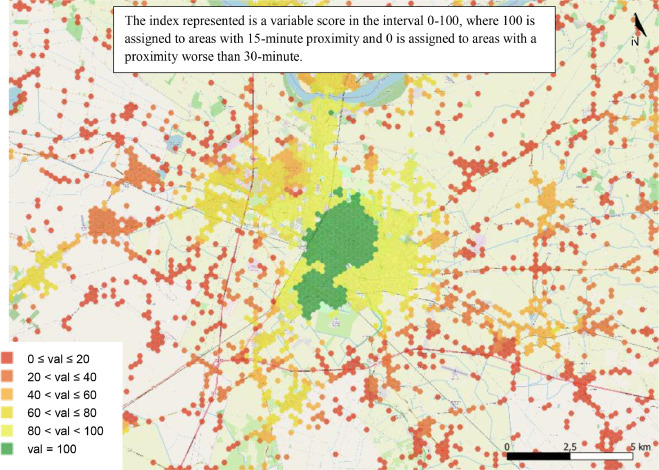
This study analyzes Seoul’s cultural and heritage site accessibility using the 15-minute city framework. GIS mapping reveals spatial disparities: central sites lack transit and walkability, while peripheral areas struggle with safety and equity. The research suggests decentralizing cultural infrastructure, expanding multimodal transit, and enhancing walkability to align with Seoul’s Vision 2030 for sustainable, inclusive urban development.